

Clogher in Full Voice
The Atlantic was absolutely hammering Clogher Beach when I got down there a few weeks ago. A proper winter swell rolling in through the gap between the headlands, each wave stacking up and throwing that incredible translucent green you only get when the light catches the water from behind. An Fear Marbh sat out there…
When the Atlantic Catches Fire
The cold at Cappagh Beach the morning I made this photo was the sort that makes you question every life choice that led you to a dark car park before dawn. The sunrise wasn’t that great but shortly before we left, the sun cracked through a gap in the cloud and turned the entire Atlantic…
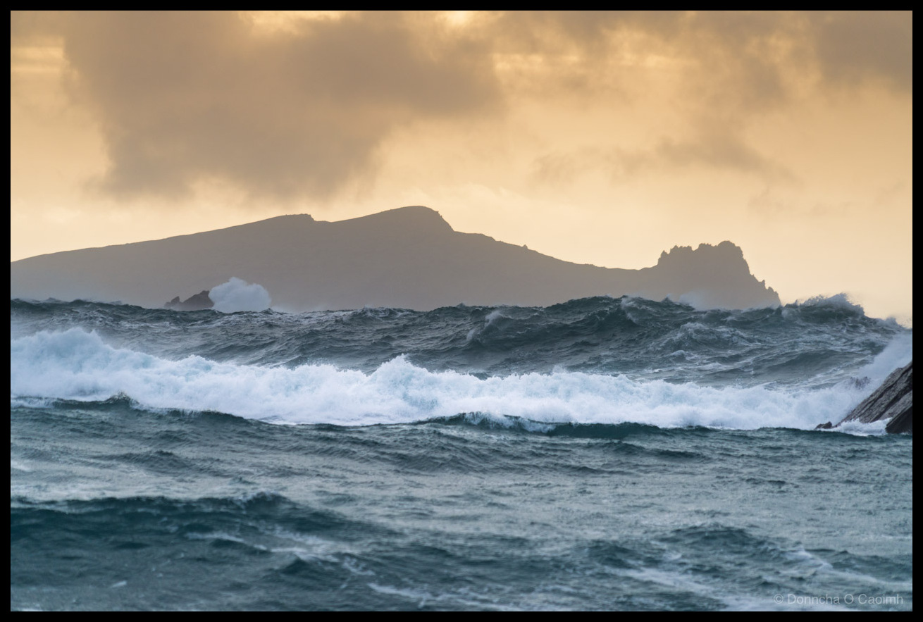
An Fear Marbh Through the Storm
On a calm day you can sit on Clogher Beach and see An Fear Marbh lying peacefully on the horizon, its profile supposedly resembling a body laid out in repose. On a day like this, though, you’re lucky to see it at all. The swell was stacking up in layers, each wave tall enough to…
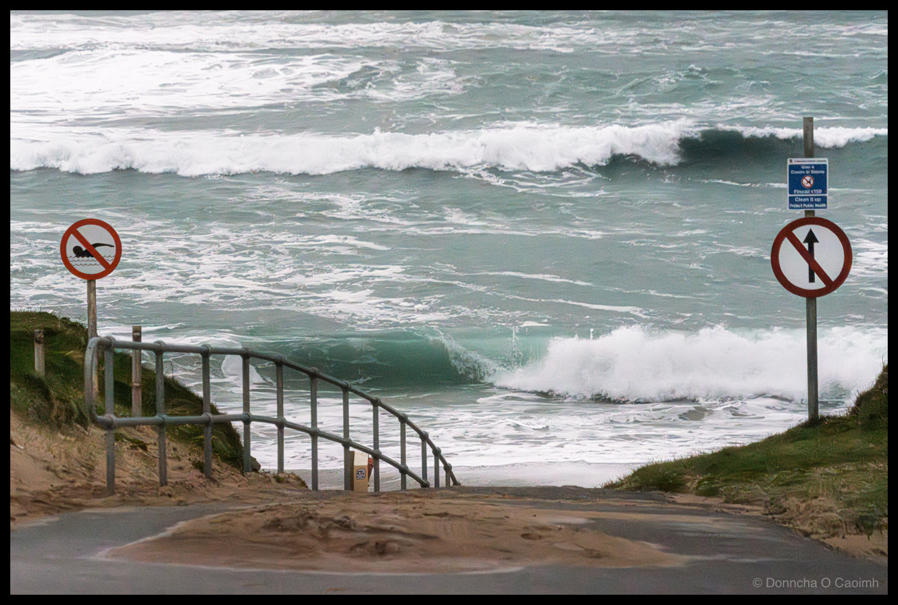
No Swimming. No Kidding.
A storm was blowing on to Clogher Beach recently. Waves so high they’d go over your head. You definitely did not want to drive down there or swim.
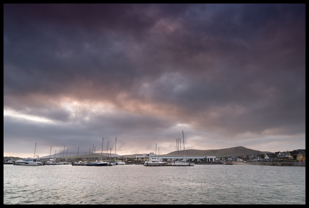
Storm Brewing Over Dingle
Dingle Marina sat there looking calm and civilised. Boats were tucked in, masts upright, everything in order while the sky overhead threatened rain and hid any chance of a sunset from my vantage point. Luckily, it didn’t rain. The sky just got darker and darker as the sun slipped further around the Earth. The low…
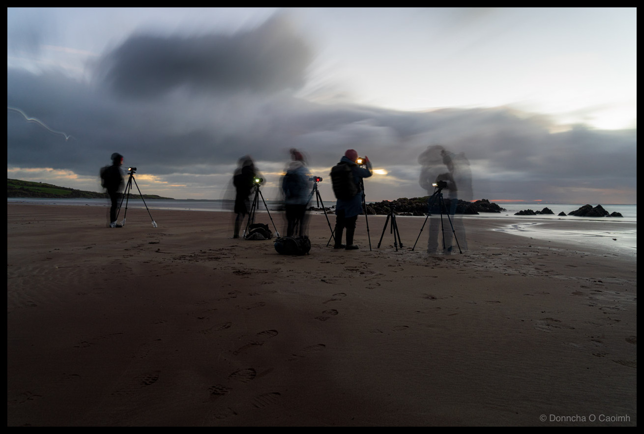
Waiting for the Light
Nothing sorts the casual photographers from the committed ones quite like an early morning alarm on a Kerry beach in March. This lot from Blarney Photography Club were out on Cappagh Strand before first light, tripods planted in the wet sand, hoods up, waiting for whatever the sky decided to offer. The long exposure in…
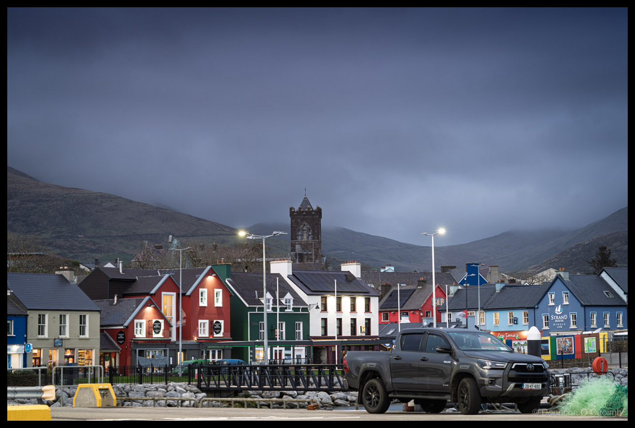
Low Cloud Over Dingle
Low clouds lay over Dingle town on Friday evening but while it wasn’t the most exciting light, it had a lovely even light without deep shadows. It was a quiet evening with only a few people out walking their dogs and even a couple of tourists!
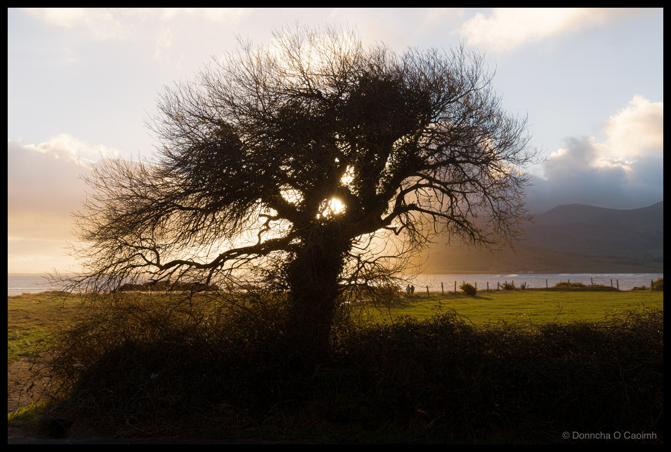
The Cappagh Sentinel
The sun had risen about 40 minutes before and we were about to leave Cappagh Beach on the Dingle Peninsula when I saw a tree silhouetted against the sun.
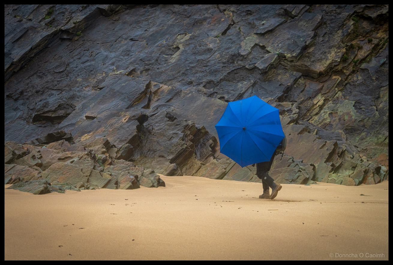
The Umbrella Photographer
Sunday’s storm on the Dingle Peninsula was the kind that turns sensible people around at the car park, but photographers are rarely sensible. I was down at Clogher Strand when the rain properly opened up. My friend and I both grabbed umbrellas trying to keep the gear dry while still getting the shot. The blue…
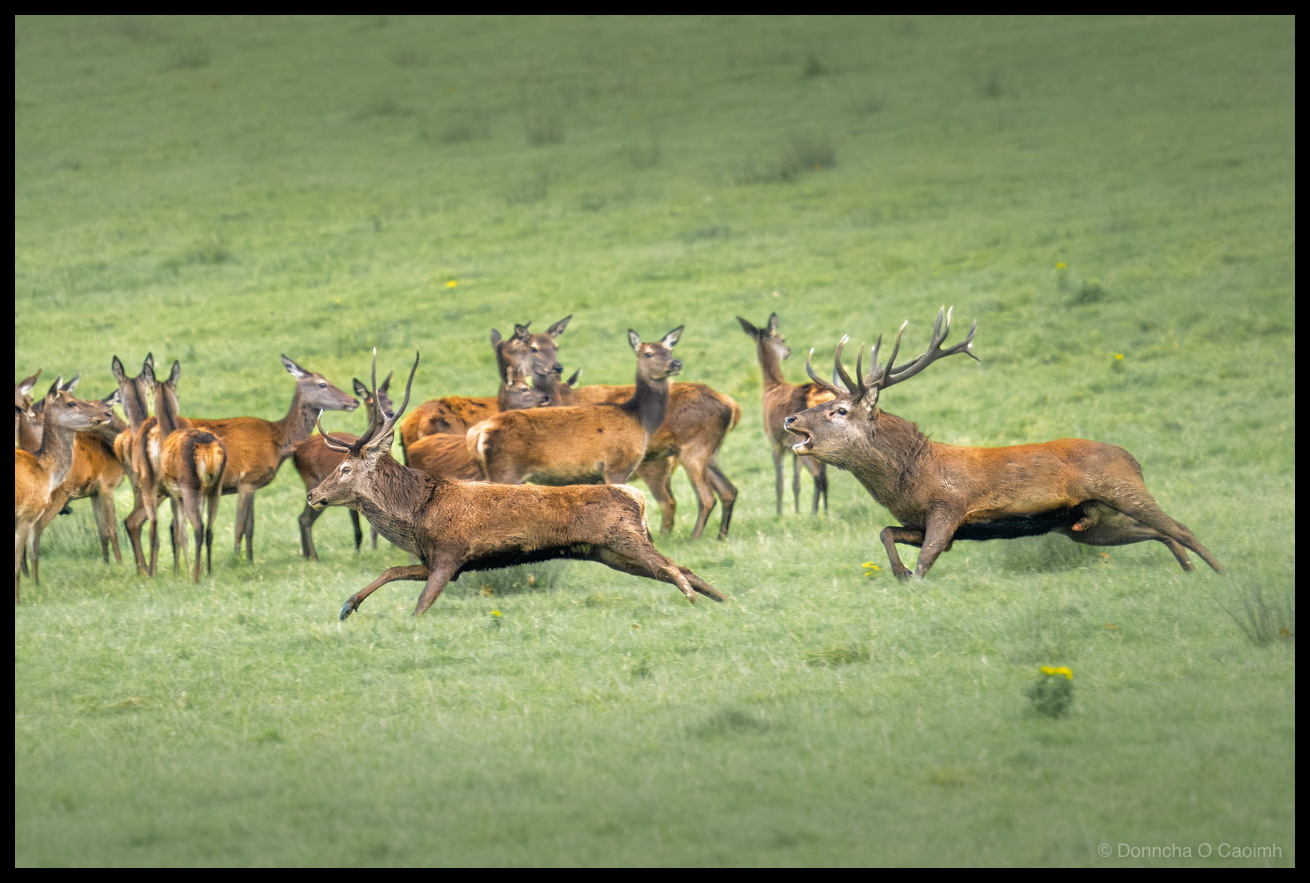
Run! A Stag Defends His Harem
Last October we spotted a herd of deer, both stags and hinds, in a field. It wasn’t long before another stag wandered in and decided to break up the party. After running around for a bit, the stag ran through the group of hinds and then walked away, trailing 3 of them!
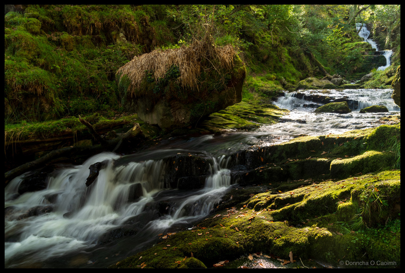
Silk and Moss in the Kerry Woods
Everyone knows Torc Waterfall in Killarney, but O’Sullivan’s Cascade is a hidden gem at the other end of the Lakes of Killarney. There is a popular legend surrounding the cascade that it was once owned by Fionn MacCumhal and whiskey rather than water flowed from it. O’Sullivan of Tomies is said to have been the…
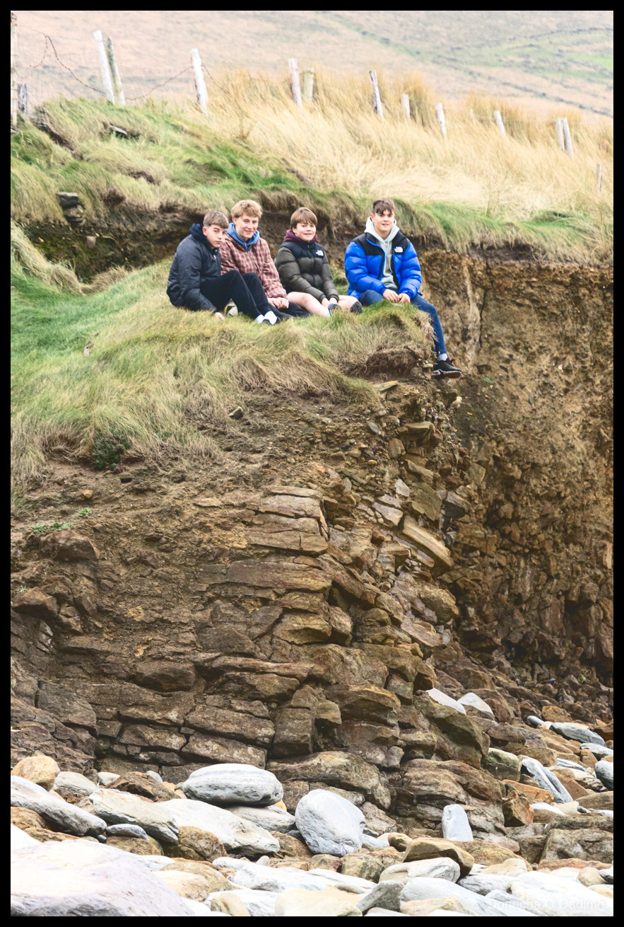
The Cliff Sitters at Clogher Strand
When we arrived at Clogher Strand for a photography session last month I spotted a group of teenagers sitting in the grass. I just realised something. They weren’t looking at their phones!