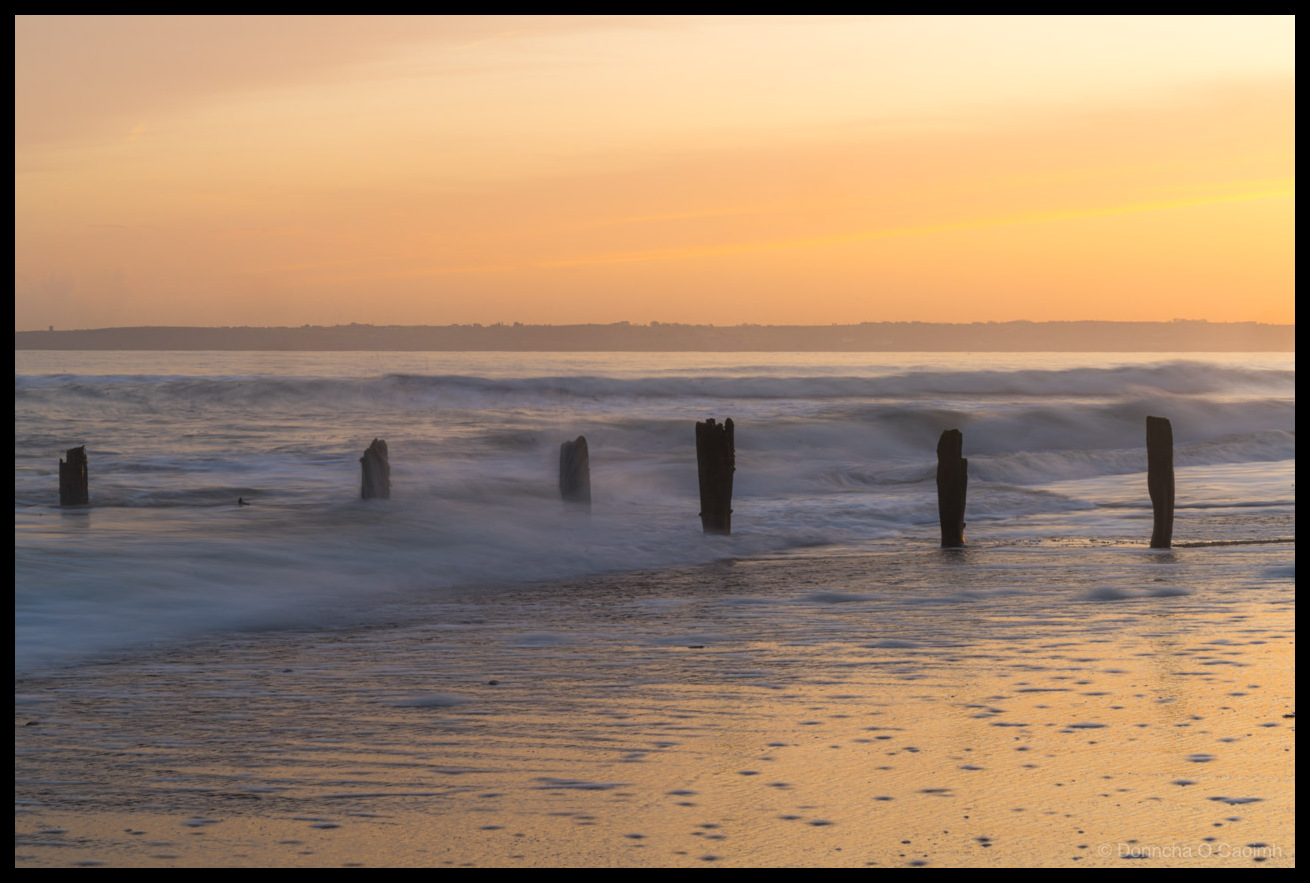
December Light at Youghal
I love taking photos on the beach at Youghal, especially at sunset. This is from a few days ago when the sun was really low in the sky, and it was shining directly along the beach, rather than from behind the beach as it is during the summer! Youghal (pronounced “Yawl”) has one of the…
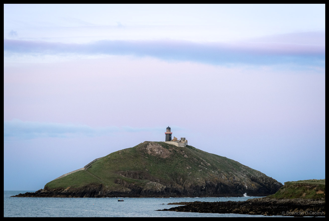
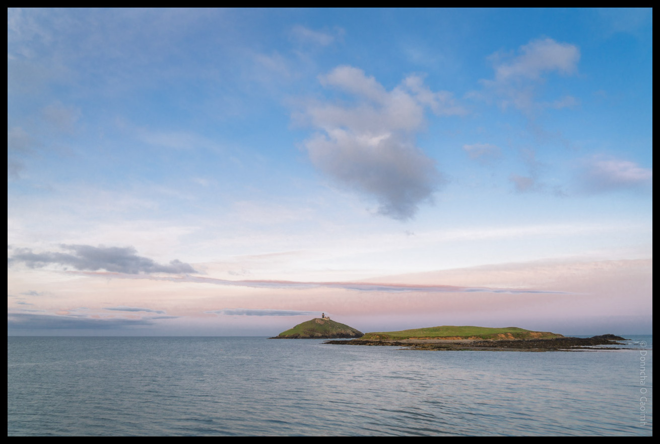
Ballycotton’s Beacon on the Island
The lighthouse on the island just off the coast by Ballycotton is always a nice subject for a photo. The night we were there, we hoped to photograph the moon rising behind the lighthouse but a large bank of cloud covered the horizon.
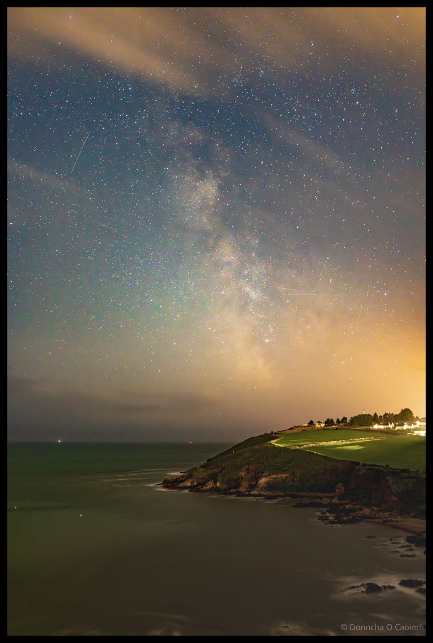
Church Bay’s Cosmic Cathedral
The Milky Way as seen from just above Church Bay, at Weaver Point, in Co. Cork. This was last night, a few minutes after the moon had set. Unfortunately, the centre of the galaxy was hidden behind a bank of clouds at the horizon. The forecast said there would be about 30% cloud, but thankfully…
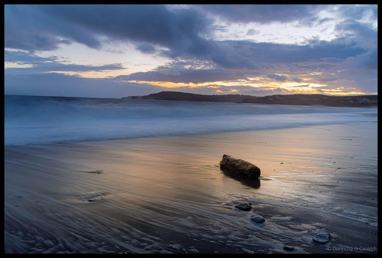
Driftwood at Owenahincha
Last night Blarney Photography Club travelled to Owenahincha Beach to do some seascapes. We hoped to do some Milky Way photography later in the evening too but cloud cover got thicker and after some socialising in the nearby Celtic Ross Hotel we went home.
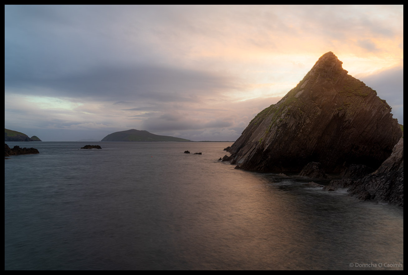
Dunquin’s Dramatic Edge
Dunquin Harbour is mostly photographed from the cliffs above because there is a narrow winding path that descends on a steep trajectory to sea level. As I said previously in my photo of An Fear Marbh the sky was a monochrome grey but suddenly the clouds dispersed and some of the lovely light of the…
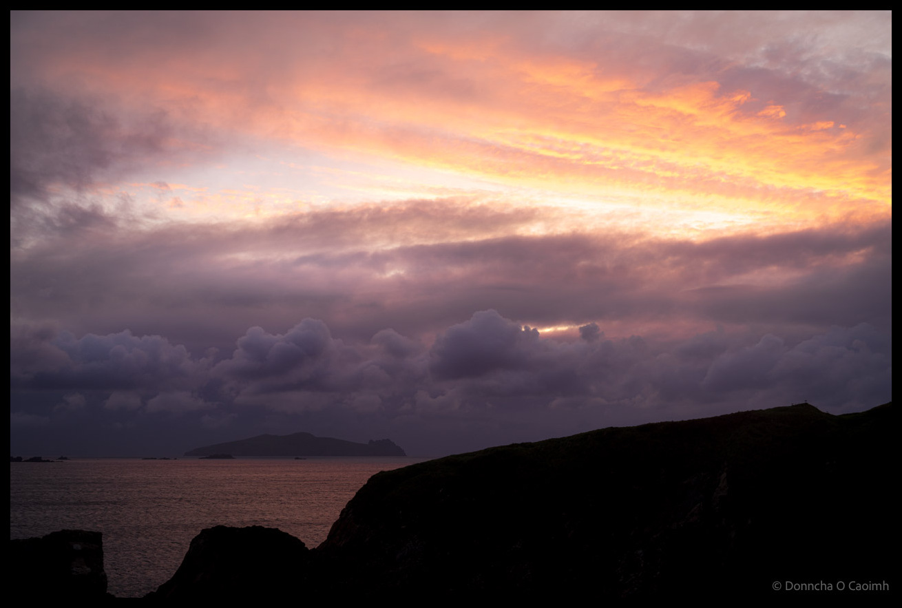
An Fear Marbh at Sunset
It looked like there wouldn’t be any sunset, but I was down at the bottom of Dunquin Pier when I saw an orange glow coming from behind the large rock blocking my view of the sun that had just set. If you know how steep that path down to the pier is, I hope you’ll…
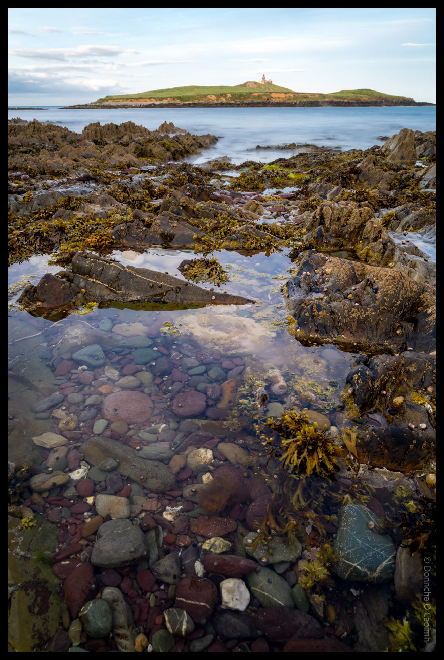
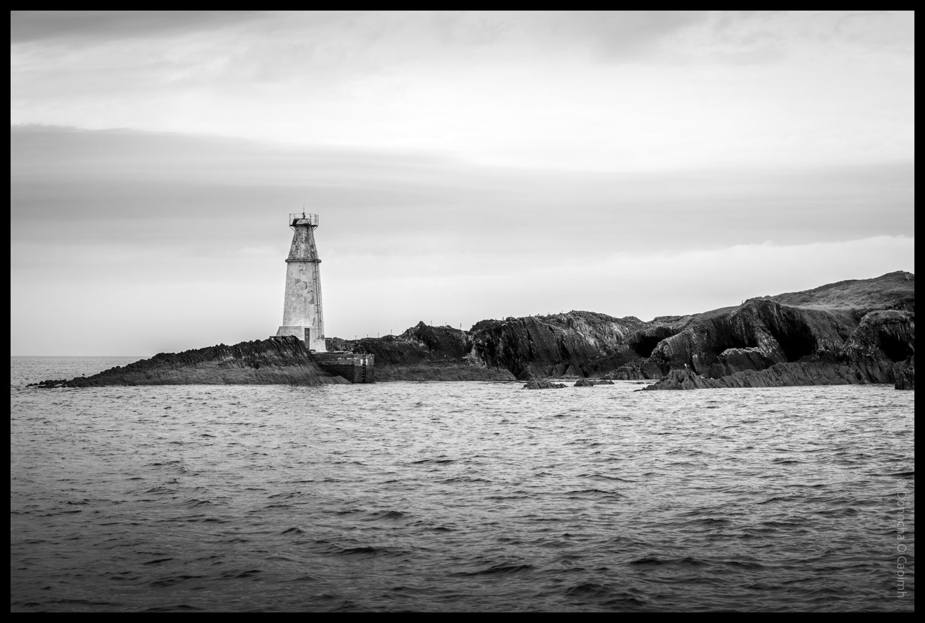
The Lighthouse and Tidal Treasures
The tide was very far out when we visited Ballycotton last week, so I wandered out on the rocks, carefully avoiding the slippery seaweed, and took a few photos.
Ballycotton’s Famous Beacon at Dusk
Ballycotton Lighthouse as pictured from the end of the pier at the village of the same name last Thursday night. It was a lovely evening. Warm and with just enough clouds to make for a spectacular sunset. The Moon was due to rise almost behind the island here, but a huge cloud bank covered the…
Copper Point Sentinel
Copper Point Lighthouse sits at the end of Long Island outside the town of Schull in Co. Cork. If you take the boat from Schull to Cape Clear, you’ll pass by here!